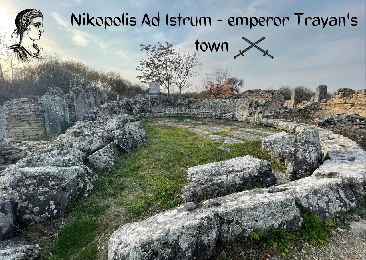
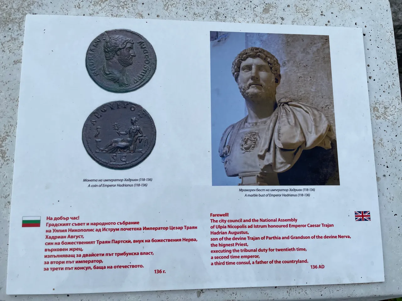
Hello, dear Hivers! Welcome to the ancient Roman city of Nicopolis ad Istrum, located near the village of Nikup - North Central Bulgaria. Today I decided to present you the history and future of this amazing city, through the eyes of my lens. The founder of the city, Emperor Marcus Trajanus, was born on 18th September AD 53 and all this has provided good grounds to accept 18th of September as a birth date of Nicopolis.
BG
Добре дошли в античния римски град - Никополис ад Иструм, намиращ се в близост до село Никюп - Северна Централна България. Днес реших да ви представя историята и бъдещето на този невероятен град, през погледа на моя обектив. Основателят на града Марк Траян е роден на 18 септември 53г. и това дава основание да се смята, че датата 18 септември е рождена за Никополис.
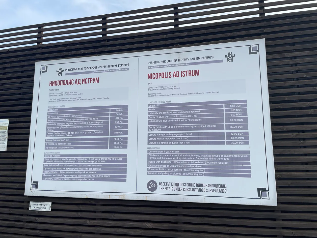
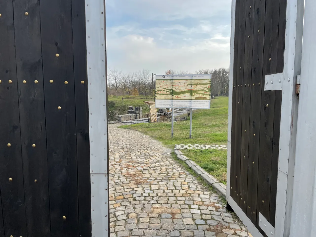
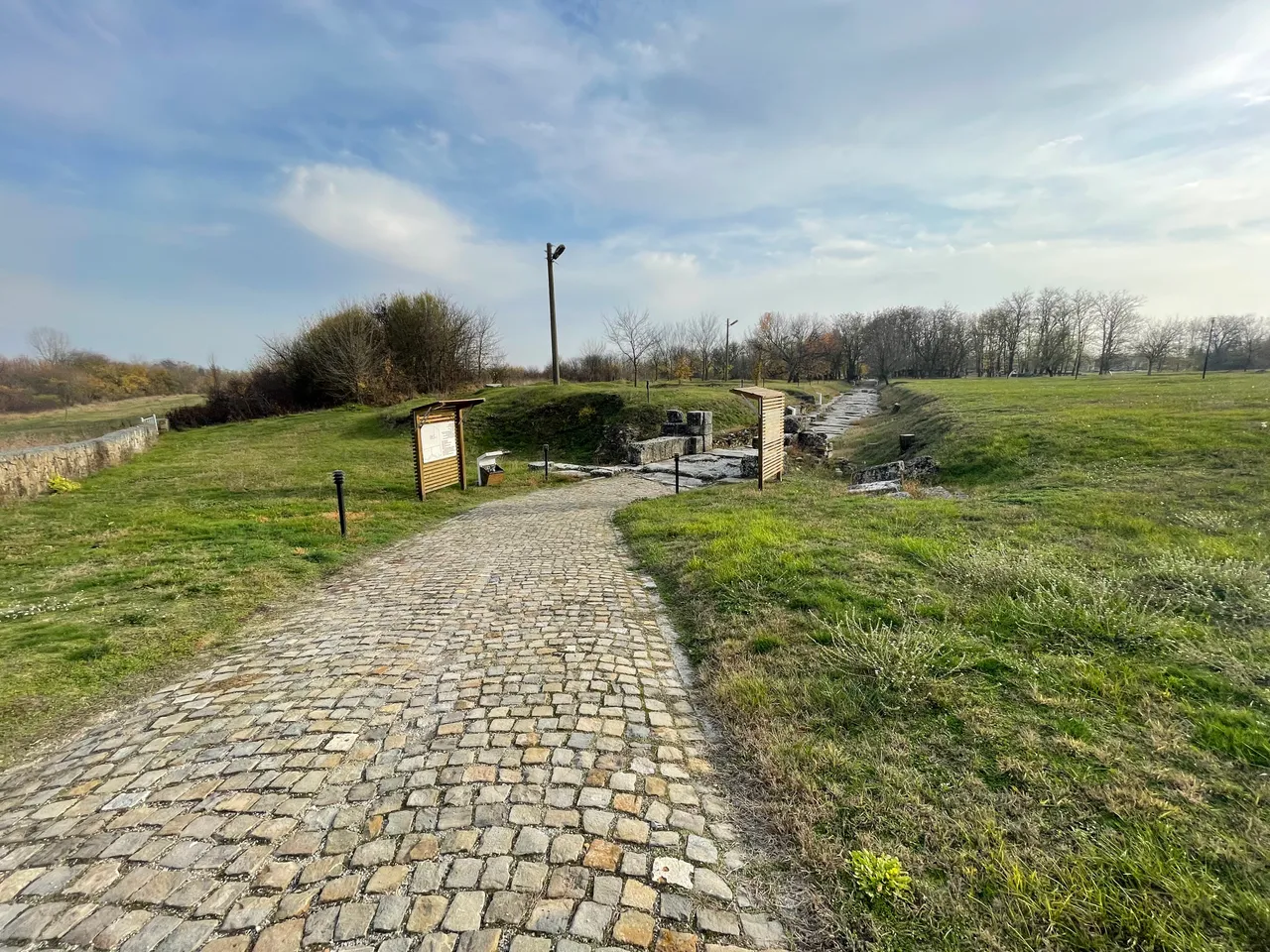
Nikopolis ad Istrum is located only about 25 kilometers from Veliko Tarnovo in the direction of Ruse. The road is asphalted and easy to reach by car. Immediately in front of the entrance of Nicopolis there is a parking lot where you can leave your car. Then we carried on to the ticket office to buy tickets. The price for adults is 6 BGN and for children and students it is 2 BGN. You can also purchase a family ticket.
BG
Никополис ад Иструм се намира само на около 25 километра от Велико Търново в посока Русе. Пътят е асфалтиран и лесно се стига до нега с кола. Непосредствено пред входа на Никополис има паркинг, на който може да оставите колата си. След което се носичихме към касата за да си закупим билети. Цената за възрастни е 6 лева, а за деца и студенти е 2 лв. Може да си закупите и семеен билет.
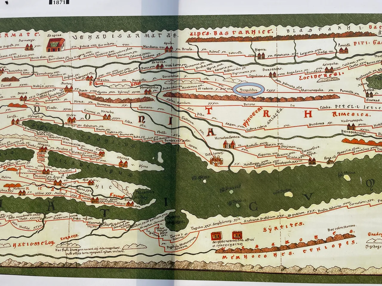
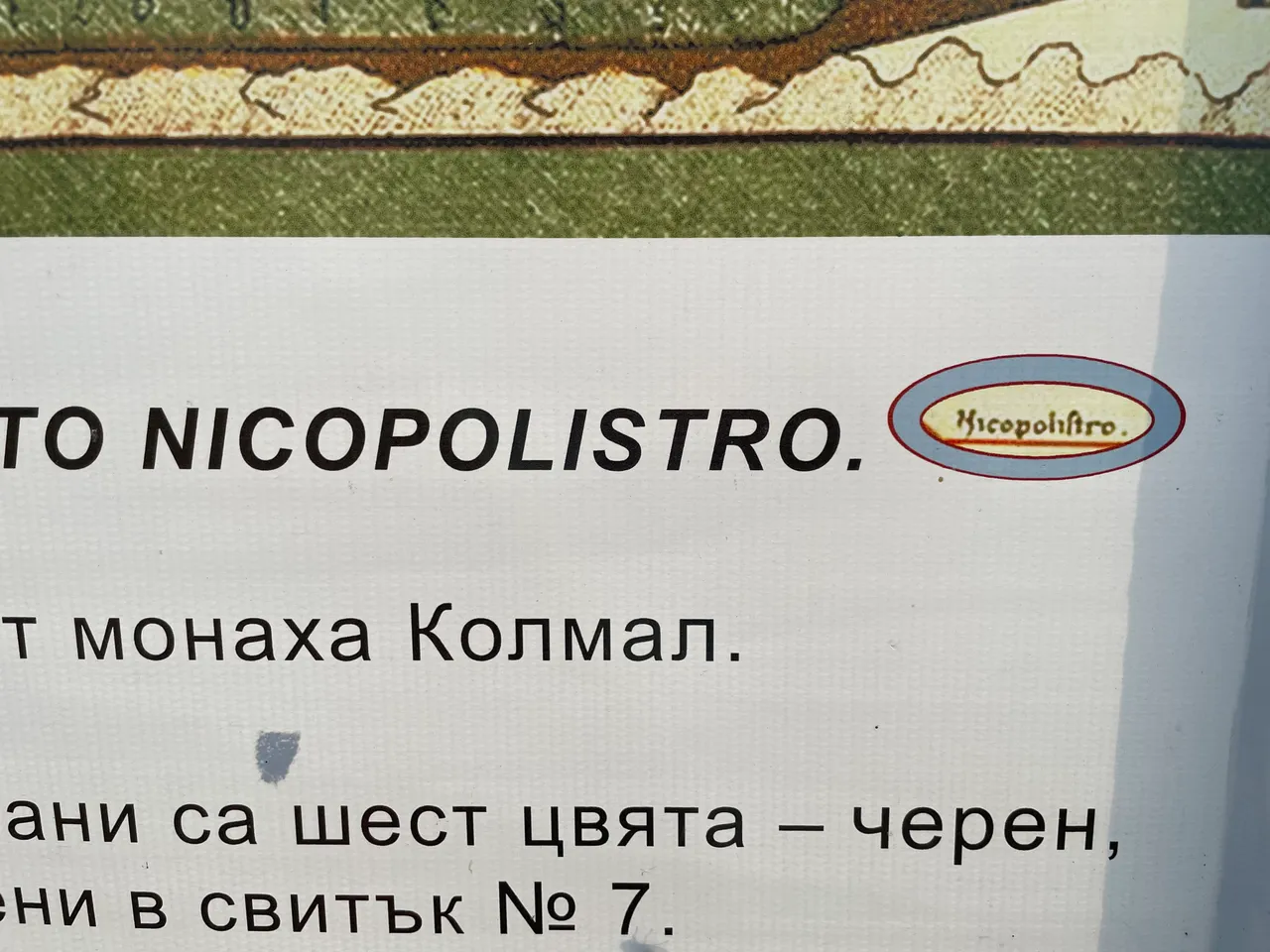
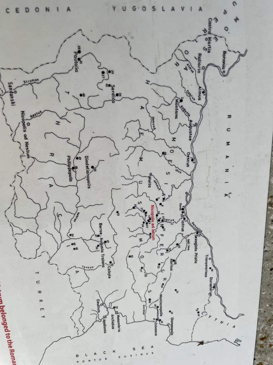
The first thing we see as soon as we walk in is an old map that shows the exact location of Nicopolis and its name in the past.
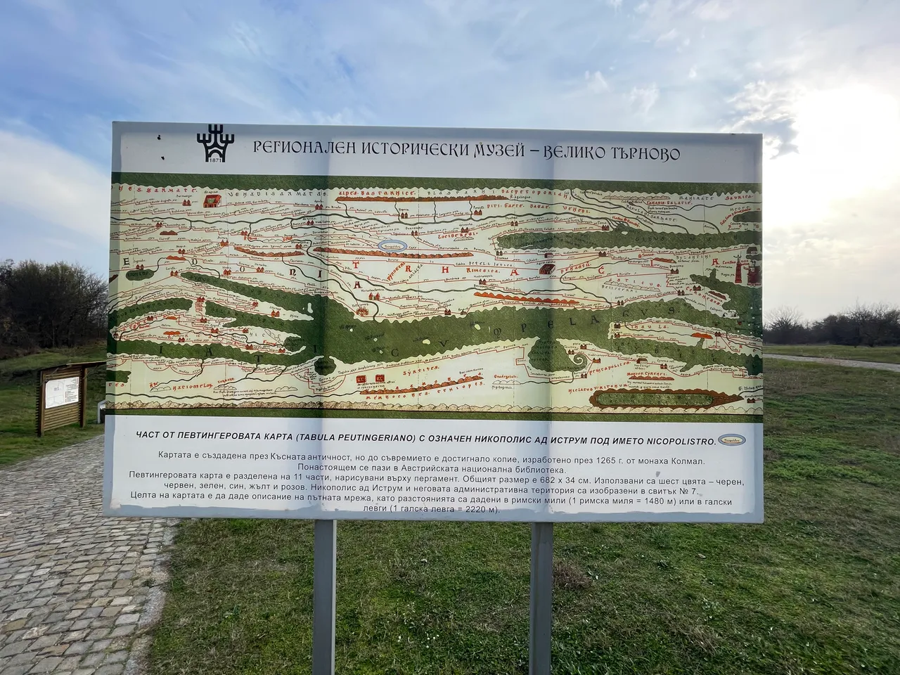
Part of the Peutinger map with Nicopolis ad Istrum marked as Nicopolistro. The map was created in late antiquity and is divided into 11 parts.
BG
Част от Певтингеровата карта с обозначен Никополис ад Иструм под името Nicopolistro. Картата е създадена през късната античност и е разделена на 11 части.
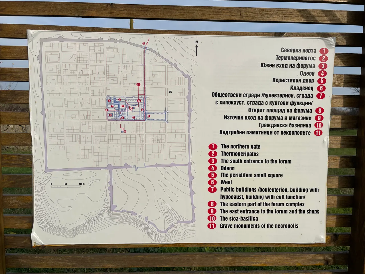
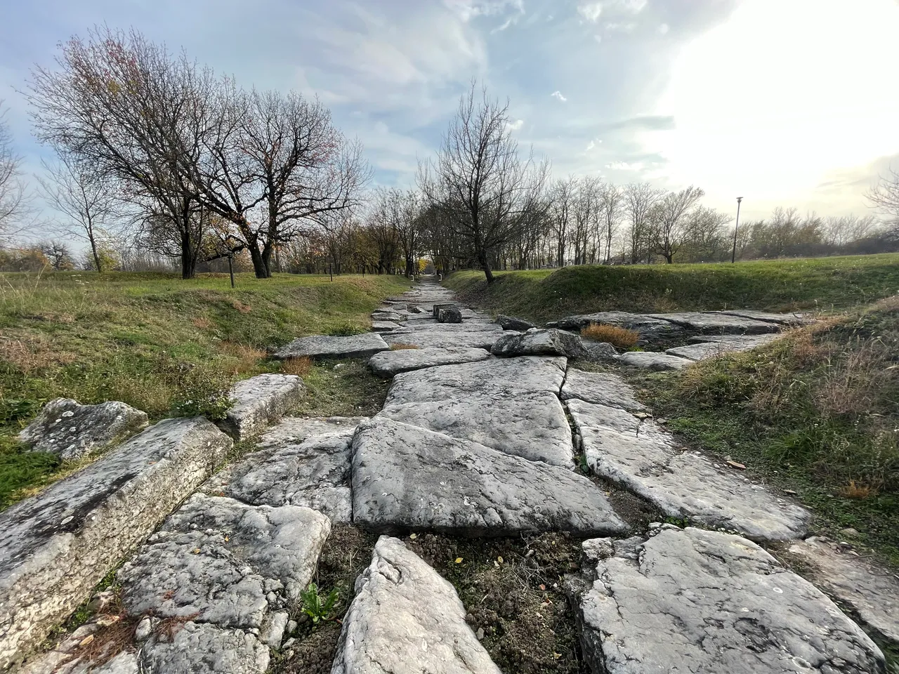
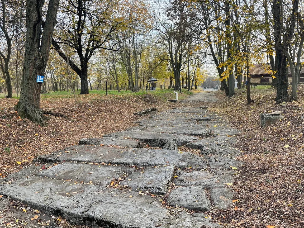
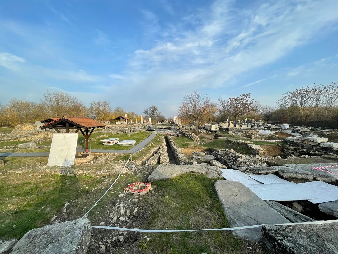
From there we took a path with posters on both sides with information. The first one showed a map of the city with all the buildings and streets.
BG
Оттам поехме по една пътека, от двете страни на която имаше постери с информация. На първият от тях беше показана карта на града с всички сгради и улици.
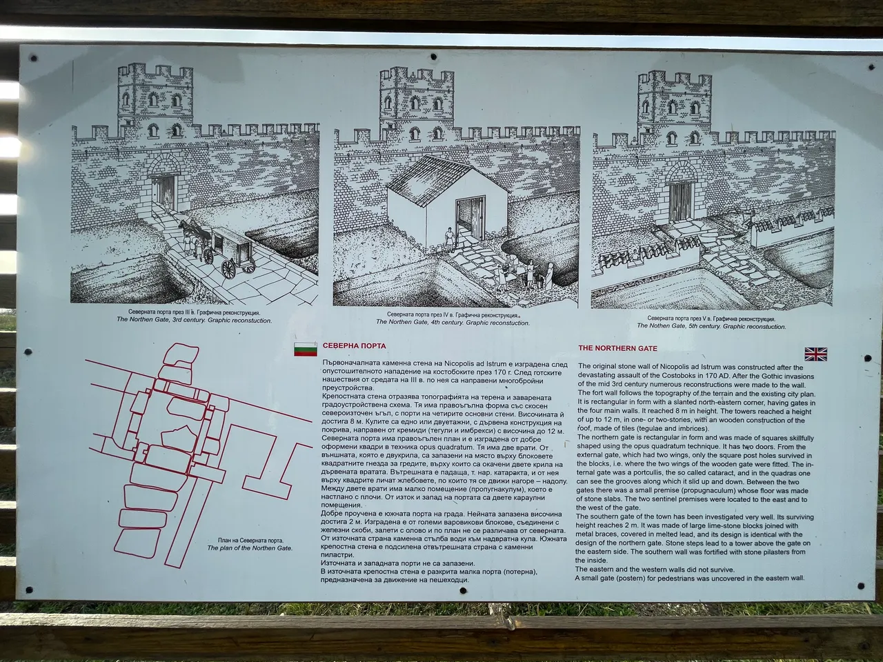
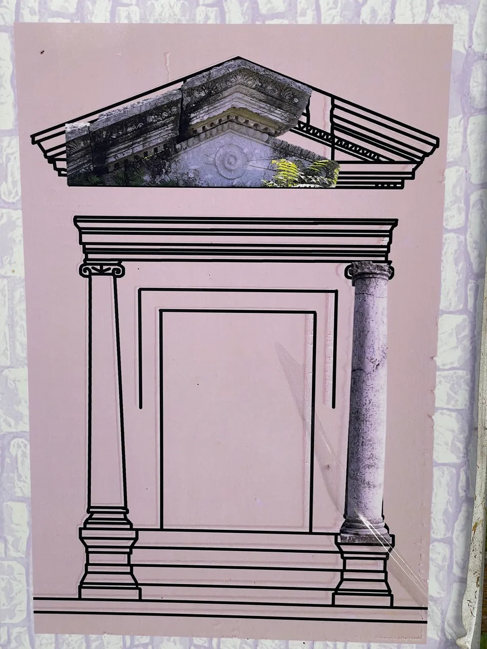
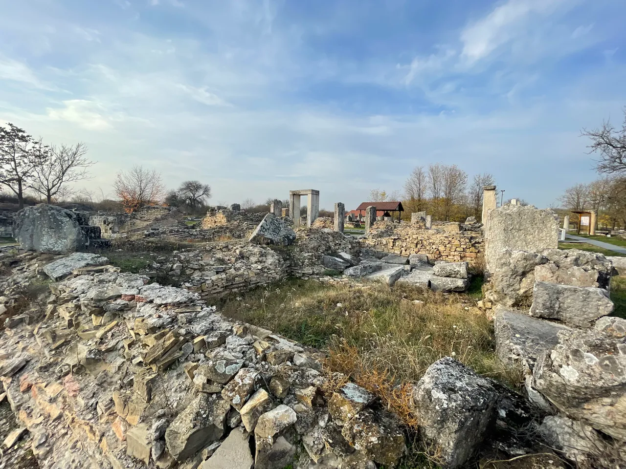
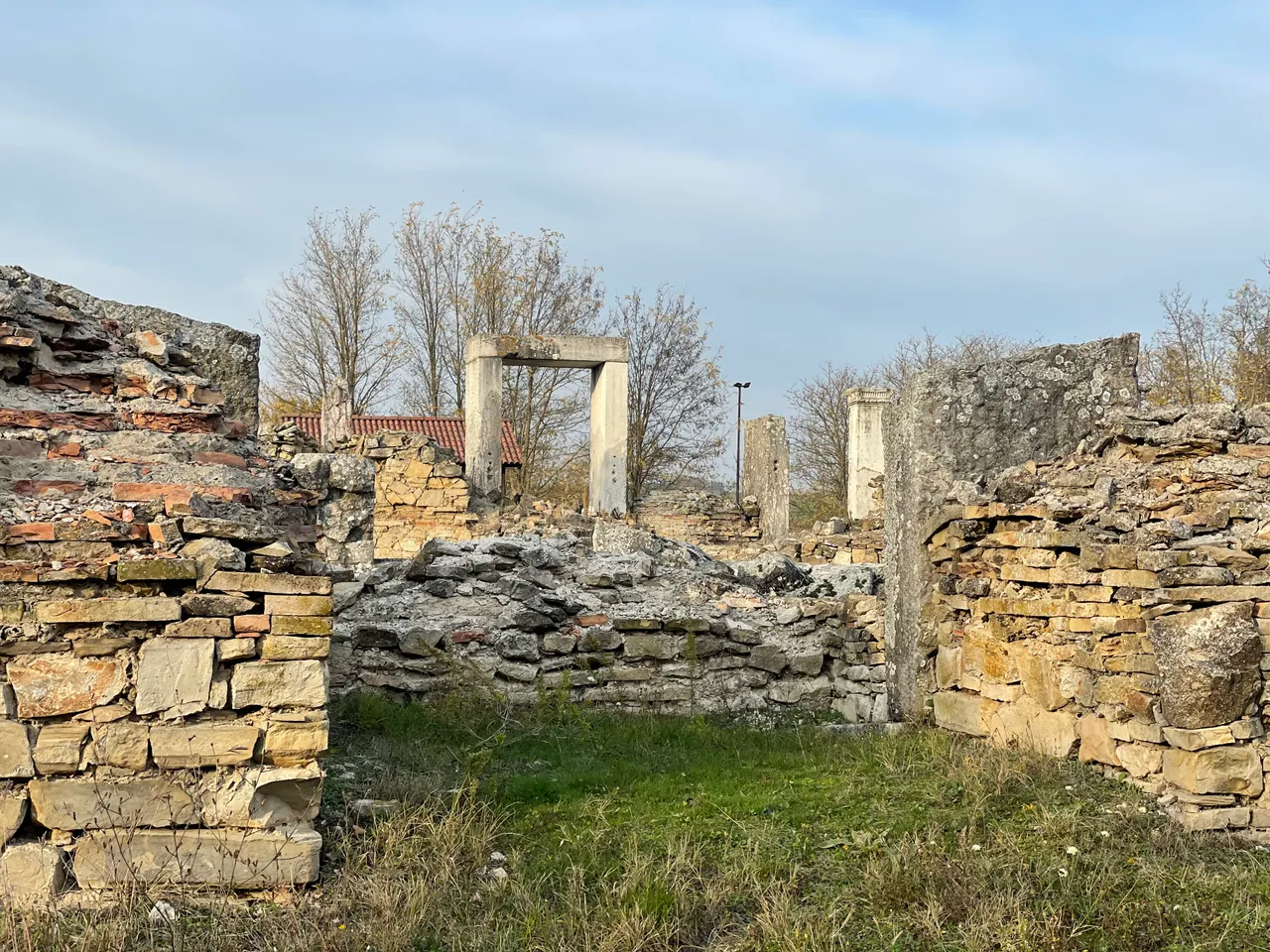
The second poster illustrated how the north(main) gate changed in the 3rd,4th and 5th centuries. The original stone wall was built after the devastating attack of the Costoboks in 170 A.D. After the Gothic invasions of the middle of the 3rd century, many alterations were made to it. The fortress wall reflects the topography of the terrain and the prevailing town planning scheme.
BG
На втория постер е илюстрирано как се е променяла северната(главна) порта през 3,4 и 5 век. Първоначалната каменна стена е след опустошителното нападение на костобоките през 170г. След готските нашествия от средата на 3 век по нея са направени многобрйни преустройства. Крепостната стена отразява топографията на терена и заварената градоустройствена схема.
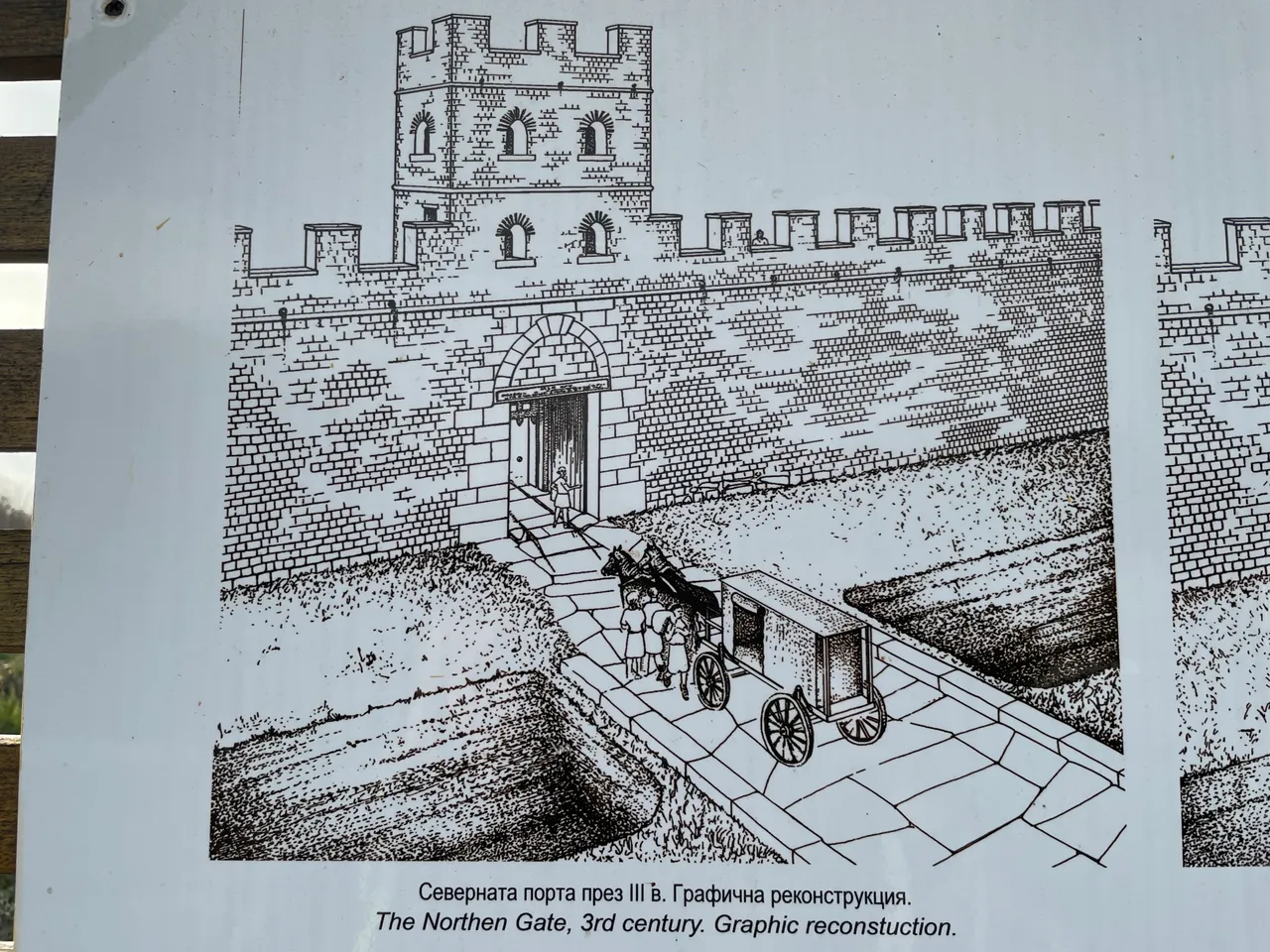
3rd century North gate
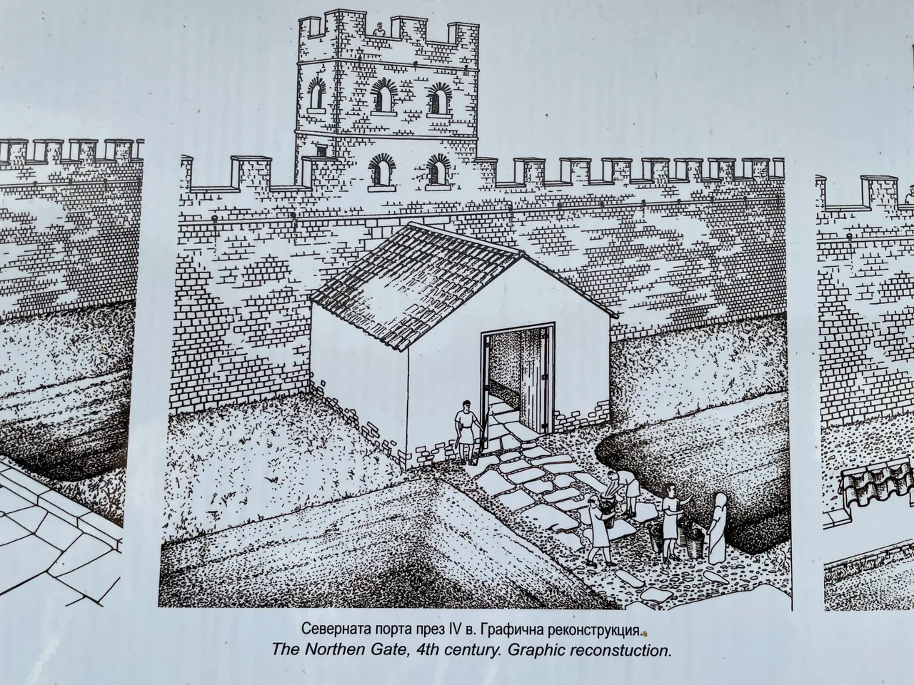
4th century North gate
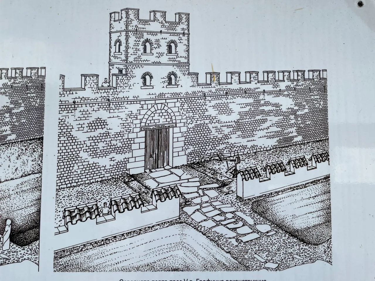
5th century North gate
Initially Nicpolis as Istrum belonged to the Roman Province of Thrace and its city territory was not large. The mid stream of the Rossitsa River seperates the territory of the city from the territory of Melta (Lovech). To the south the territory of Nicopolis borders on the territory of Augusta Trajana (Stara Zagora).To the east most probably there were large rural areas. In the early 193 AD the city was moved into the Lower Moezia Province and its city territory expanded reaching the Danube to the north.
BG
Никополис първонабално принадлежи към римската провинция Тракия и има неголяма градска територия. Средното течение на река Росица отделя земите на града от тези на Мелта (Ловеч). На юг те достигат до територията на Августа Траяна (Стара Загора). В източната посока вероятно е имало големи селски области. В началото на 193г. градът преминава към провинция Долна Мизия и градската му територия се уголемява, като на север достига до река Дунав.
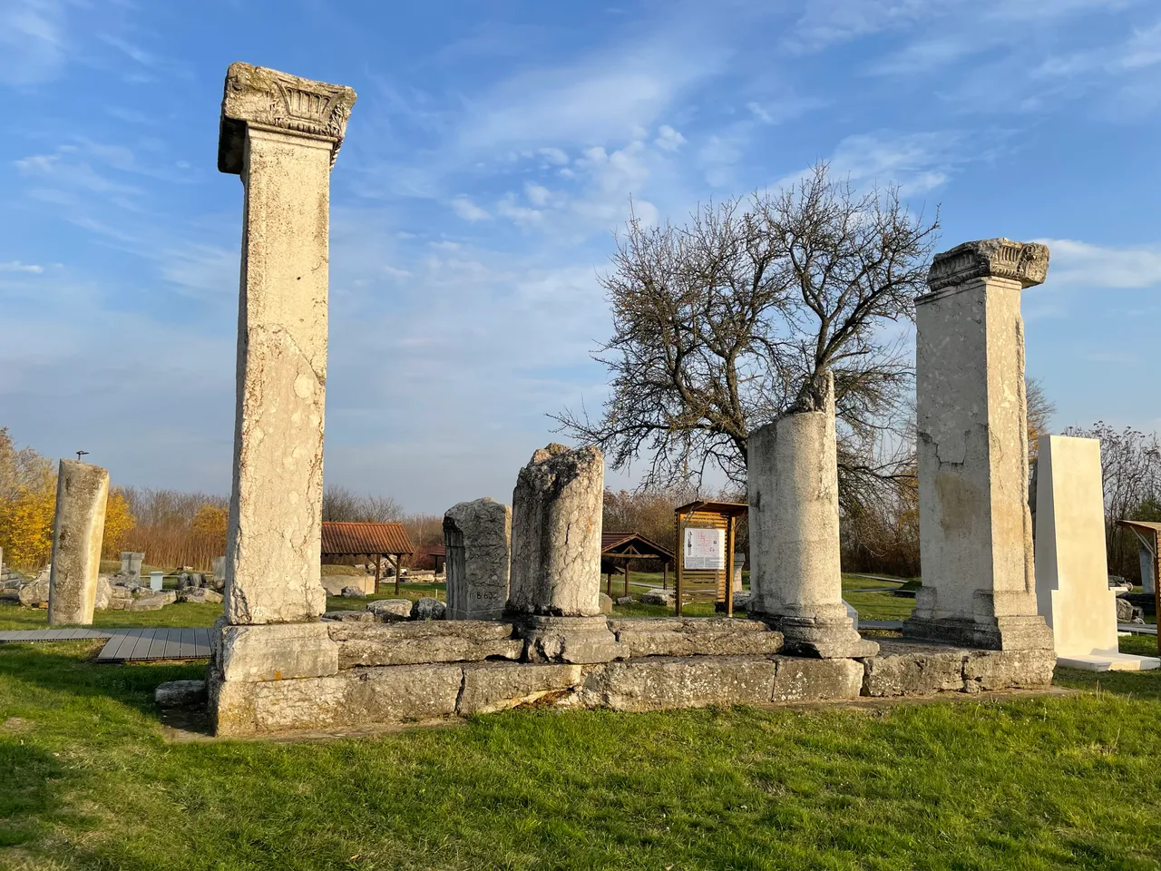
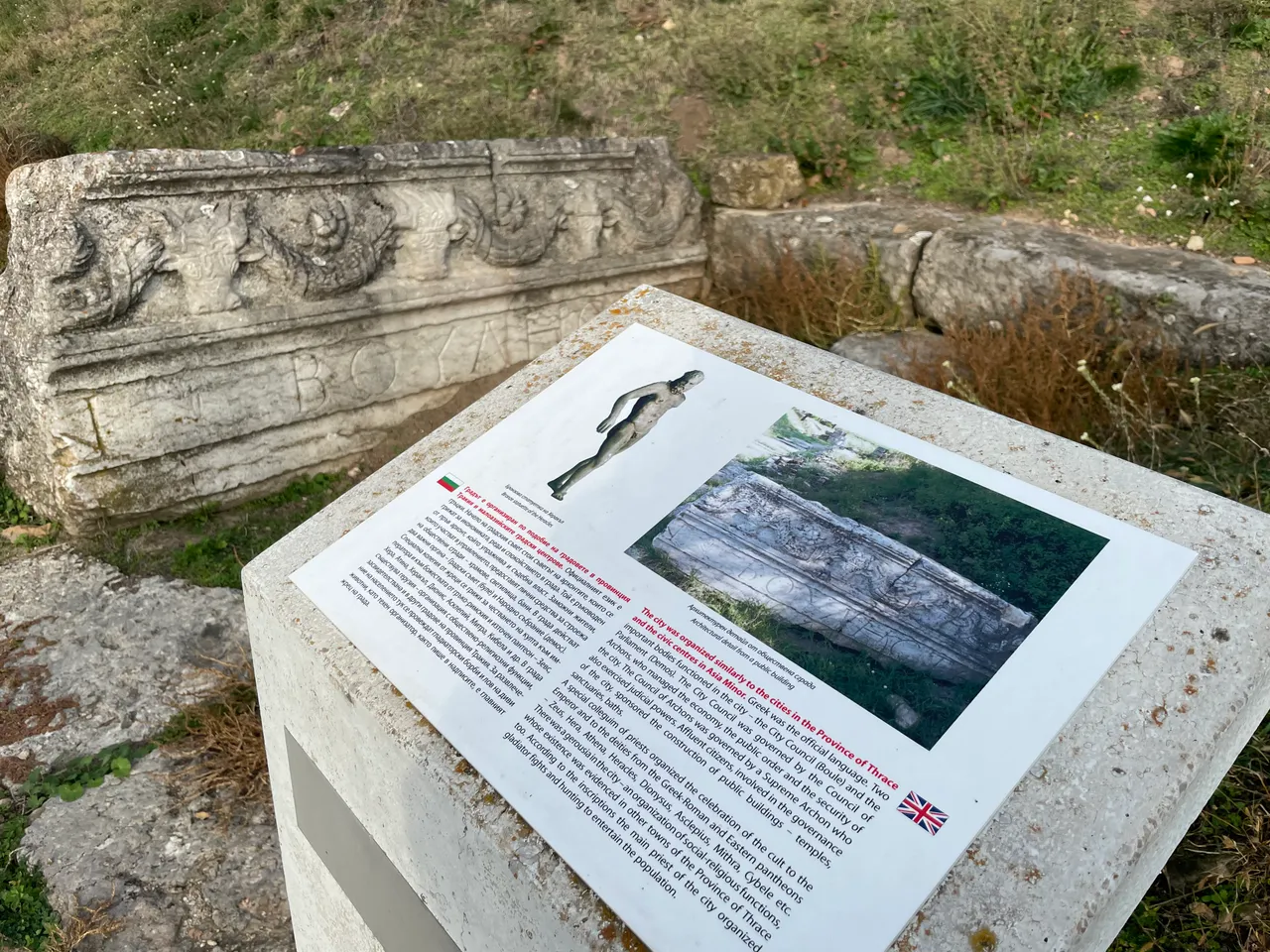
The city was organized similarly to the cities in the Province of Thrace and the civic centres in Asia Minor. Greek was the official language. Two important bodies functioned in the city - the City Council (Boule) and the Parliament (Demos). The City Council was governed by the Council of Archons, who managed the economy, the public order and the security of the city.
BG
Градът е организиран по подобие на градовете в провинция Тракия и малоазийските градски центрове. Официалният език е гръцки. Начело на градския съвет стои съветът на архонтите, които се грижат за икономиката, реда и сигурността в града.
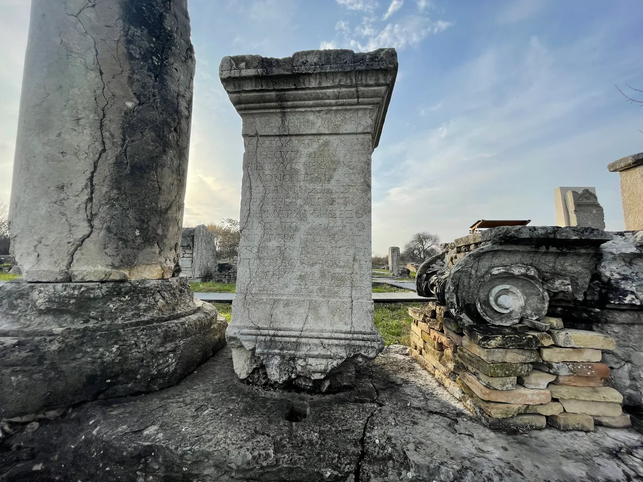
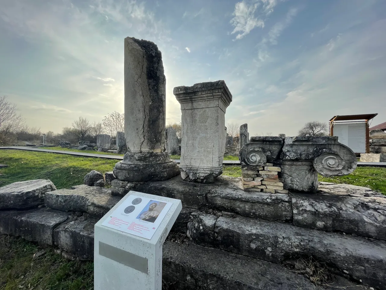
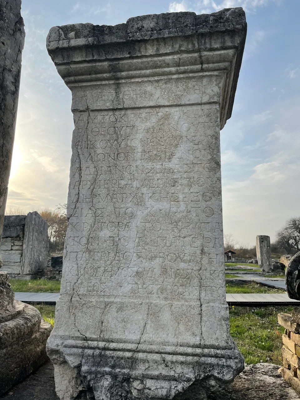
The archaeological measurements in Nicopolis have established that the cardo deflects 4,30 degrees towards northwest-southeast. There are two days in the year, when the sun has the same deflection: 31st March and 18th September.
BG
По време на проучванията в Никополис е установено, че улиците имат отклонение от 4 градуса и 30 минути към северозапад-югоизток. Две са датите в годината, когато слънцето има такова отклонение - 31 март и 18 септември.
Nicopolis reached the apogee of its economic development during the rule of the Antonine and the Severan dynasties - from the mid 2nd to the first half of 3rd century.
BG
Никополис достига своя най-голям икономически възход по време на династиите на Антонините и Северите - от средата на втори до първата половина на трети век.
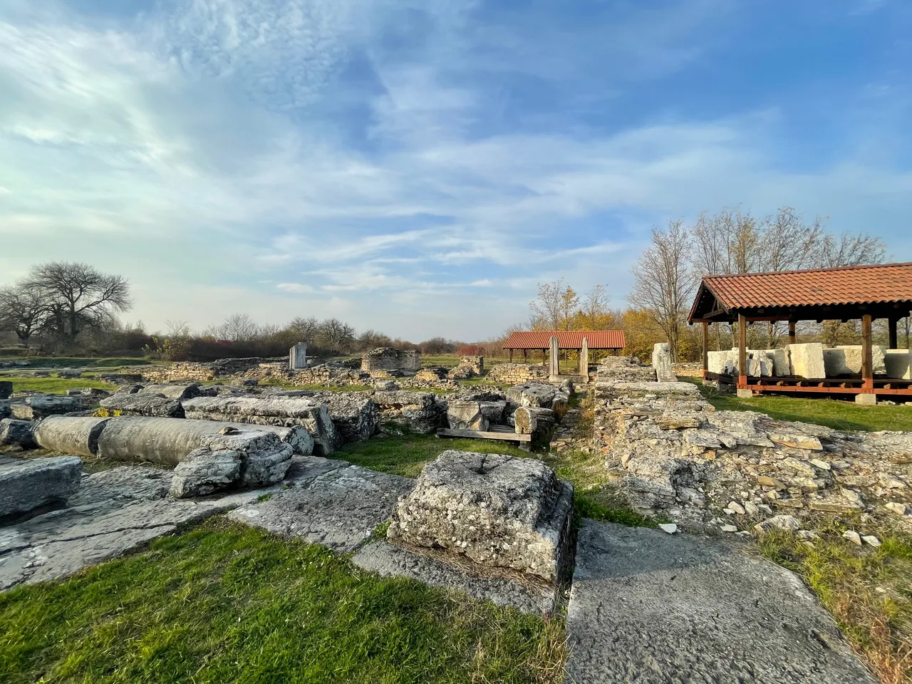
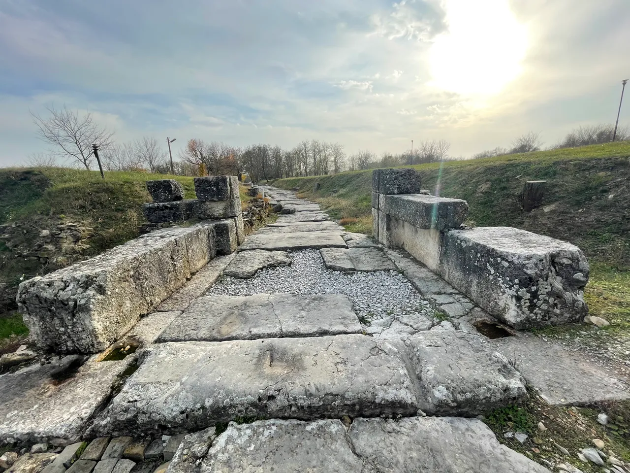
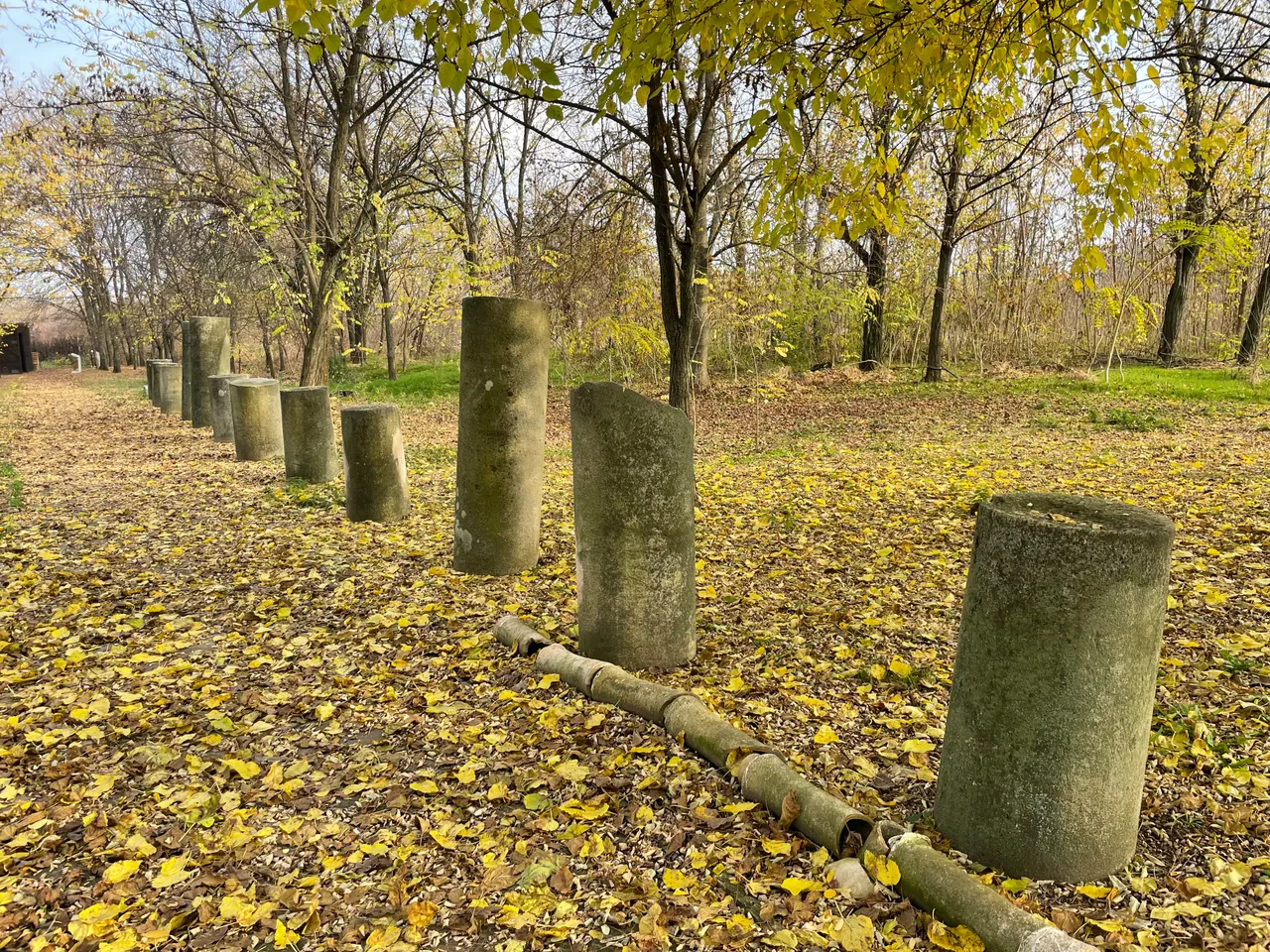
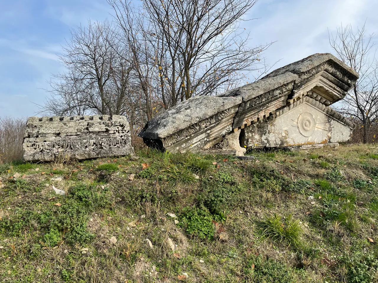
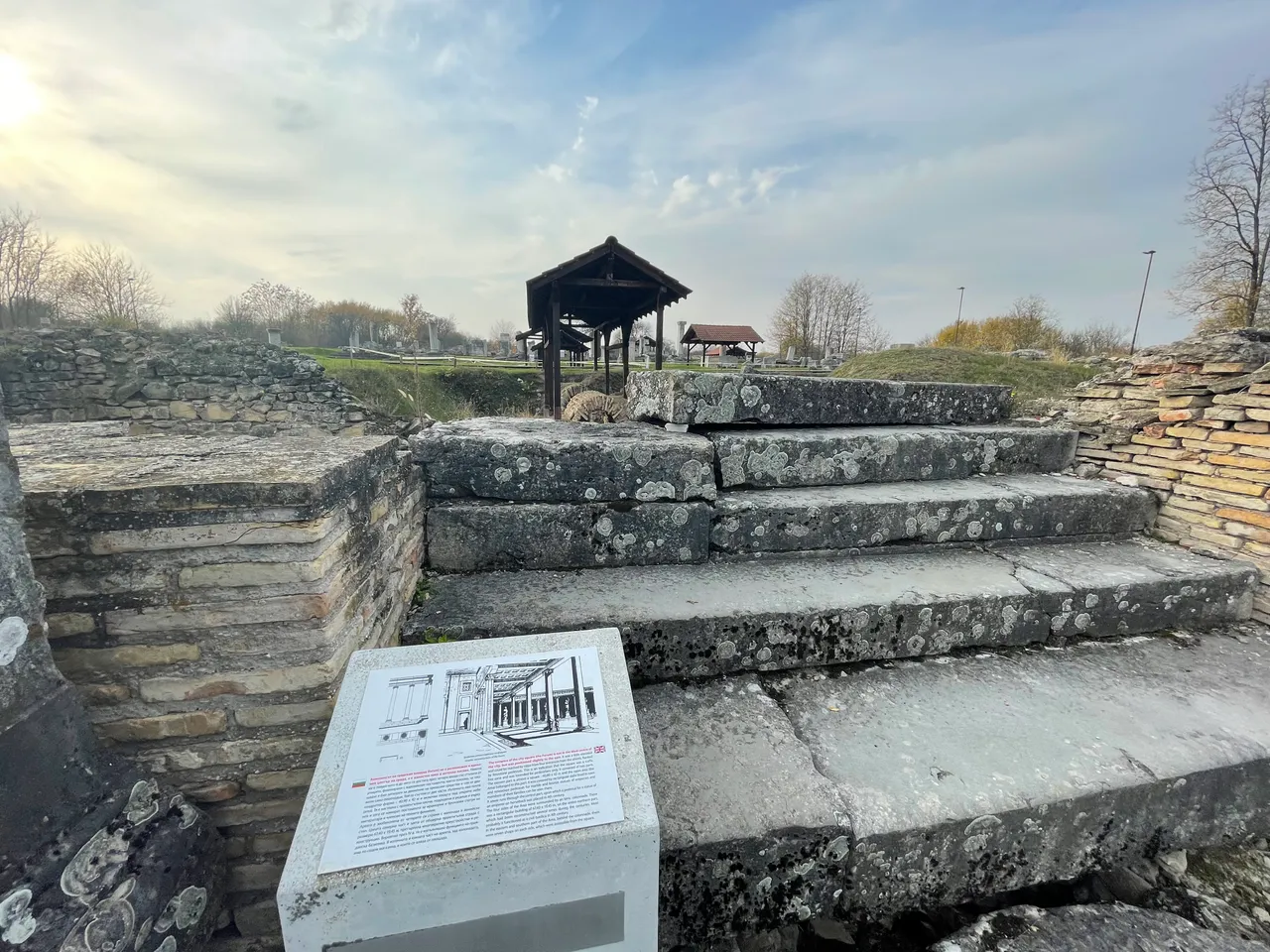
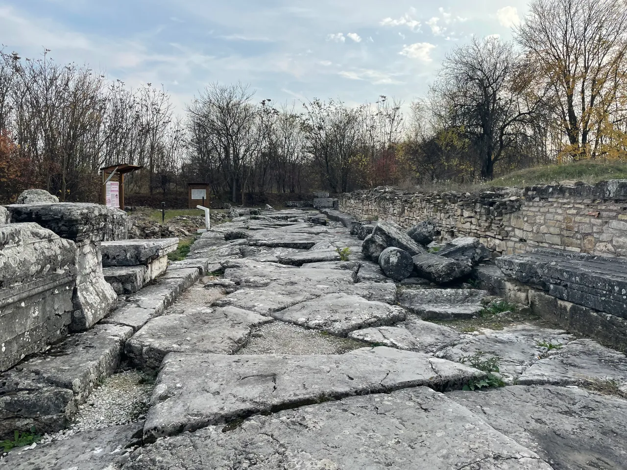
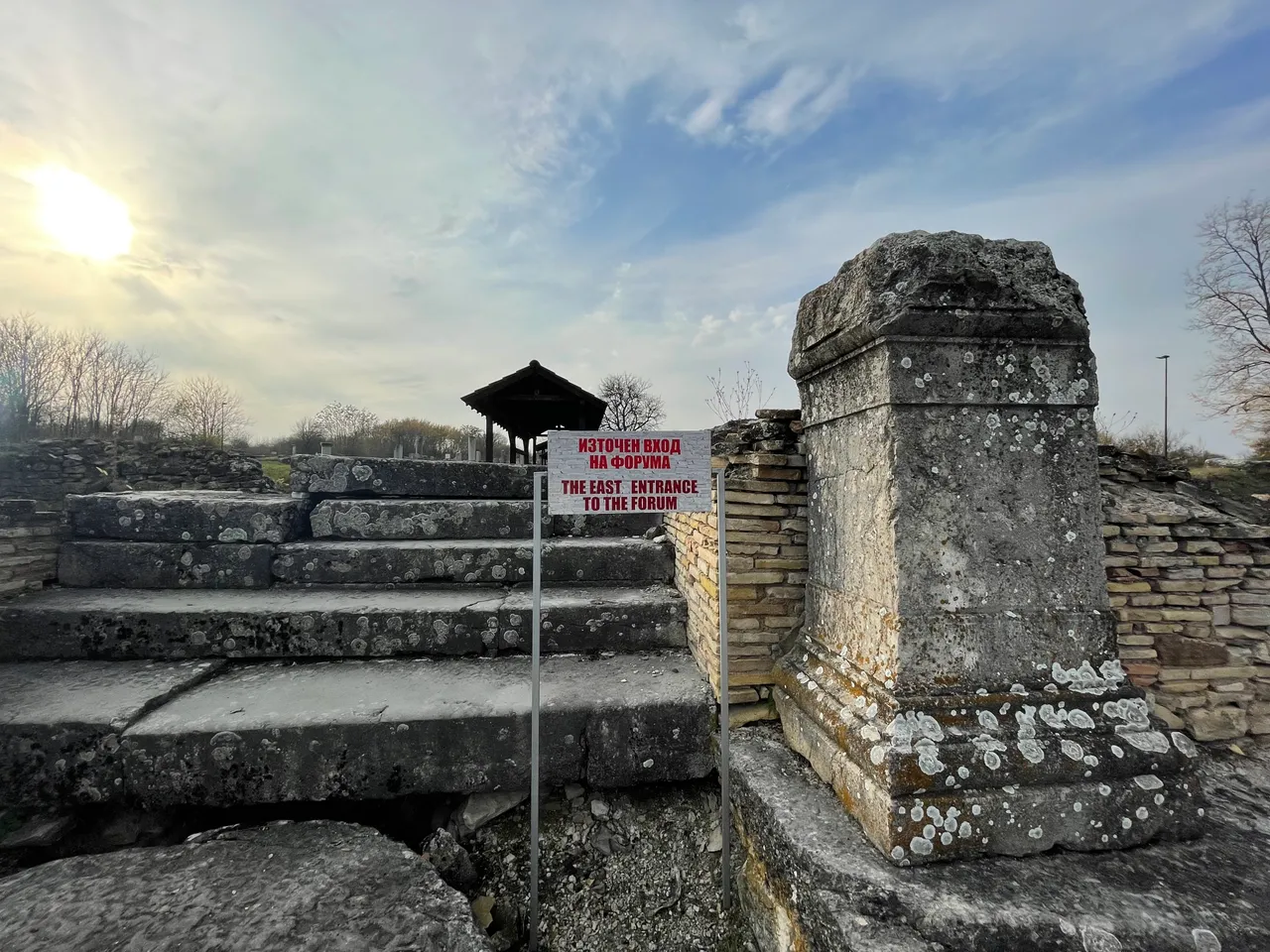
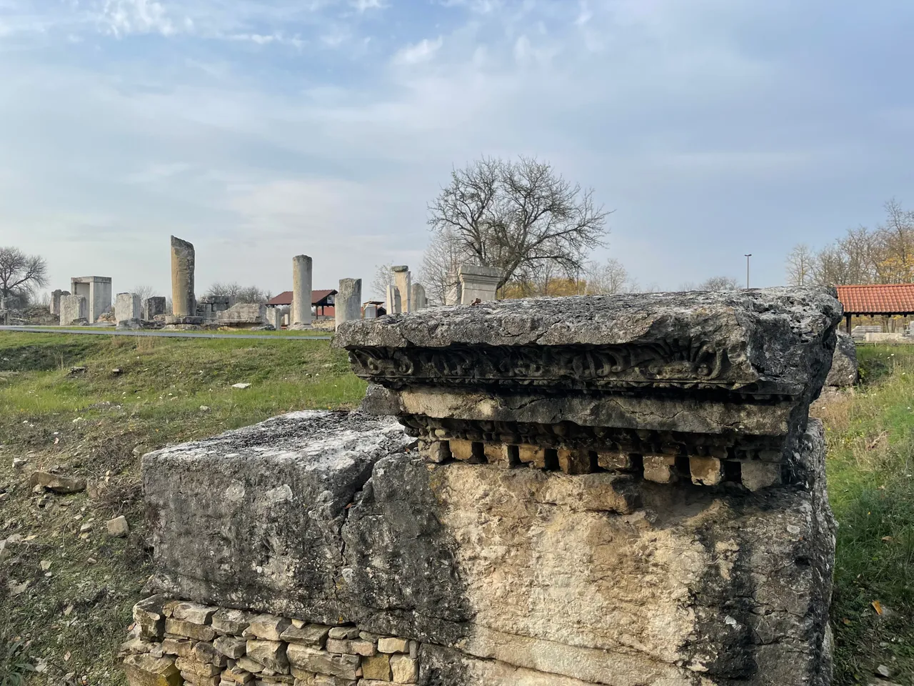
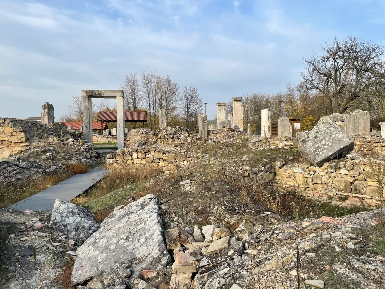
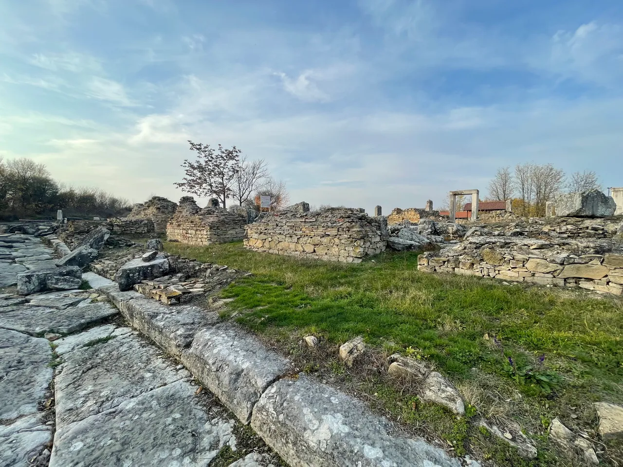
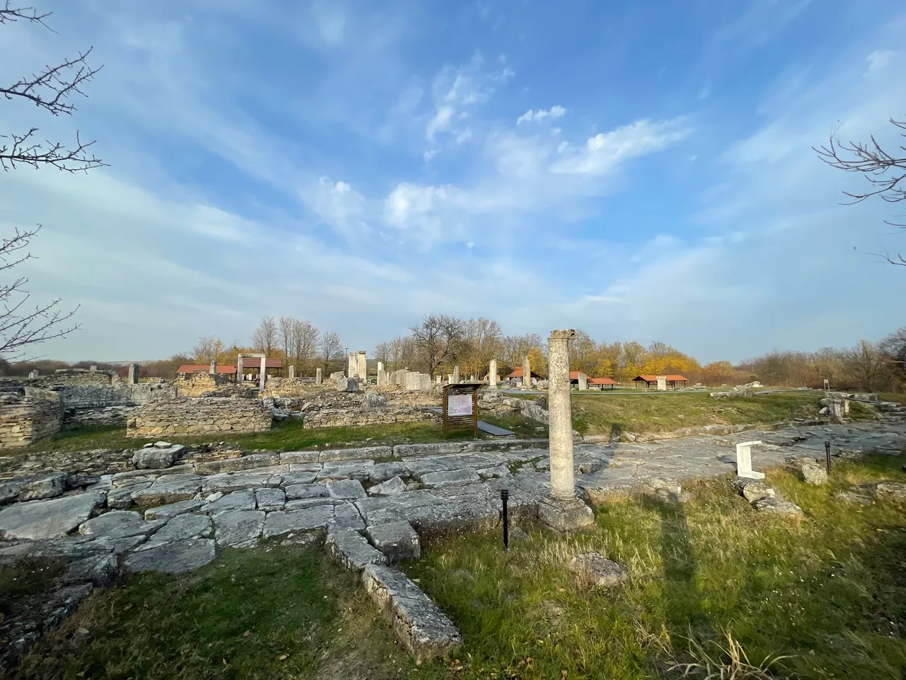
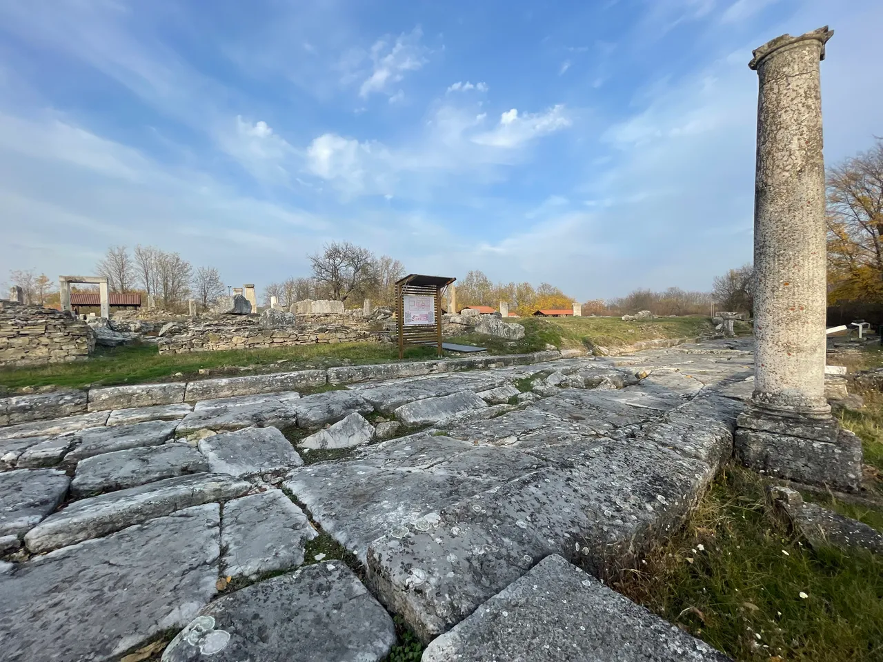
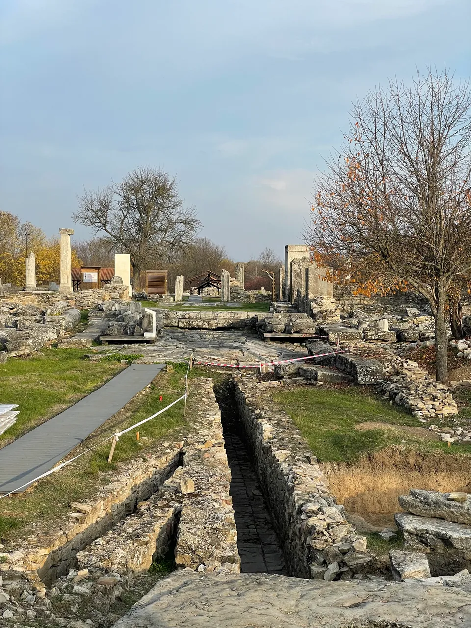
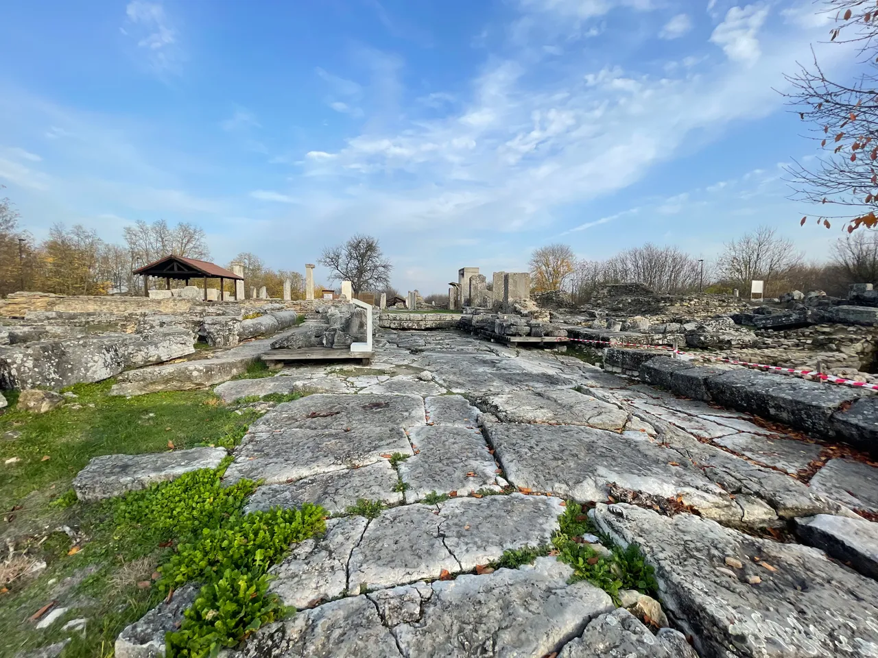
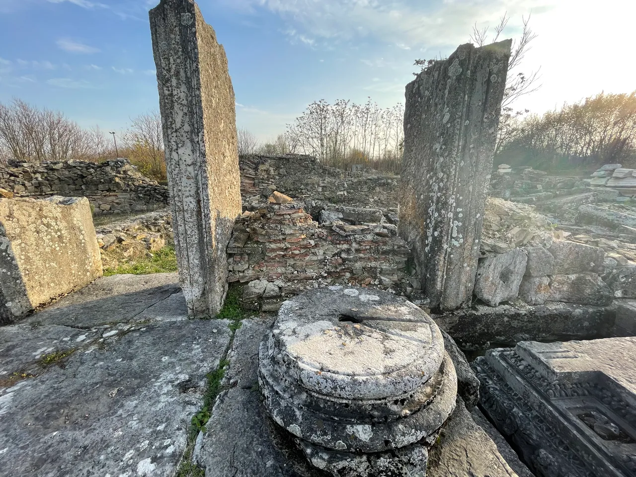
The complex of the city square (The Forum) is not in the ideal centre of the city, but was positioned slightly to the east. It was a little elevated and could be reached by steps from four entrances from the streets, flanked by limestone pedestals. This is an indication that the square was a traffic free zone and was intended for pedestrians only.
BG
Комплексът на градския площад (forum) не е разположен в идеалния център на града, а е изместен леко в източна посока. Нивото му е повдигнато и до него се стига чрез четири входа със стъпала от улиците, фланкирани с варовикови постаменти, което показва, че площадът е бил затворен за движение на превозни средства и там се движели само пешеходци.
The Thermoperipatos
The building was constructed during the rule of the Emperor Commodus and is the first building of such a name to be uncovered in the Roman Empire. It was used most probably for trading purposes, business meetings and taking walks inside.
BG
Термоперипатос
Сградата е построена при управлението на император Комод и е първата с такова име в цялата Римска империя. Сградата е служила най-вероятно за търговски сделки, делови срещи и разходки на закрито.
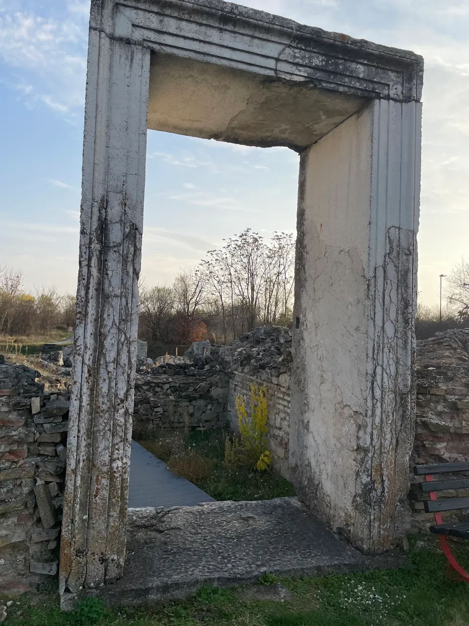
Southeast Entrance
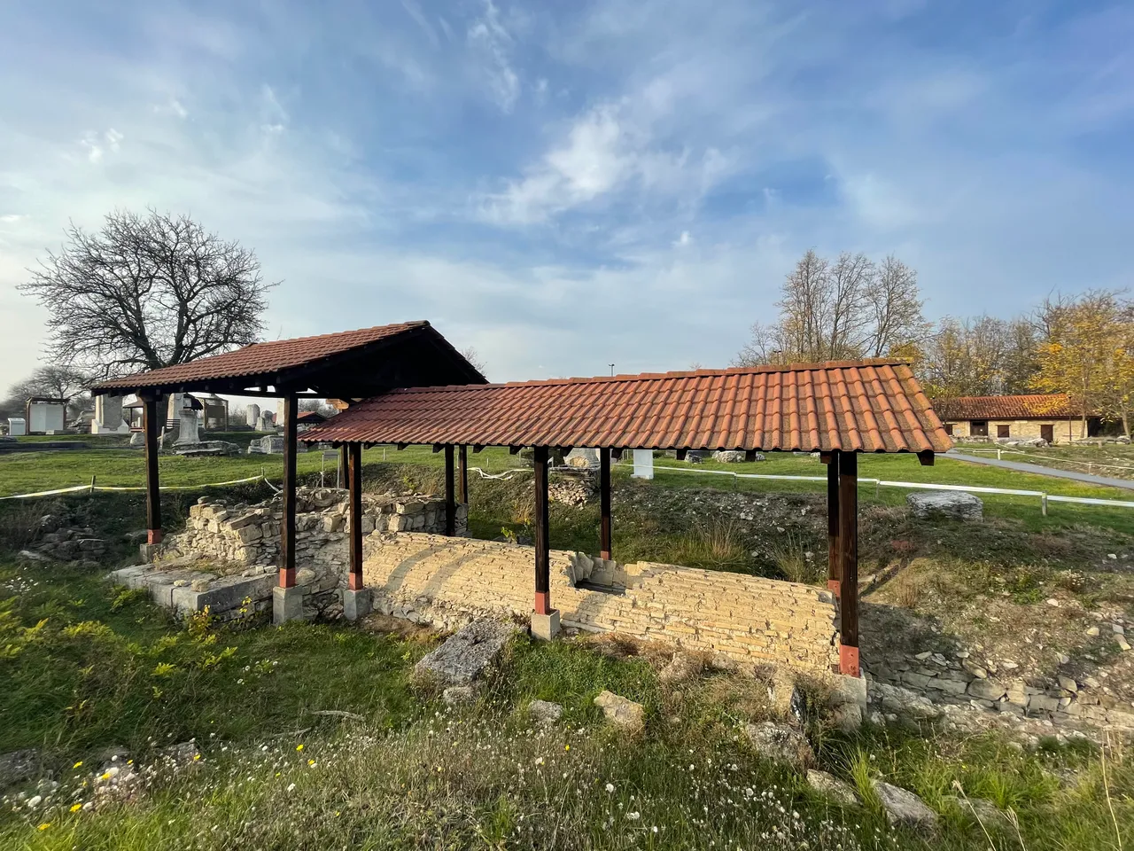
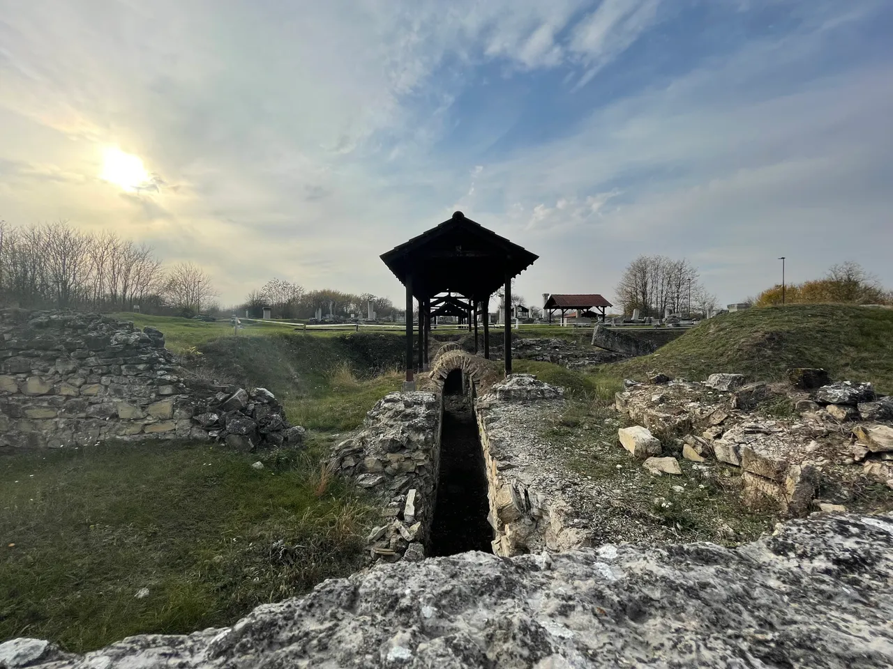
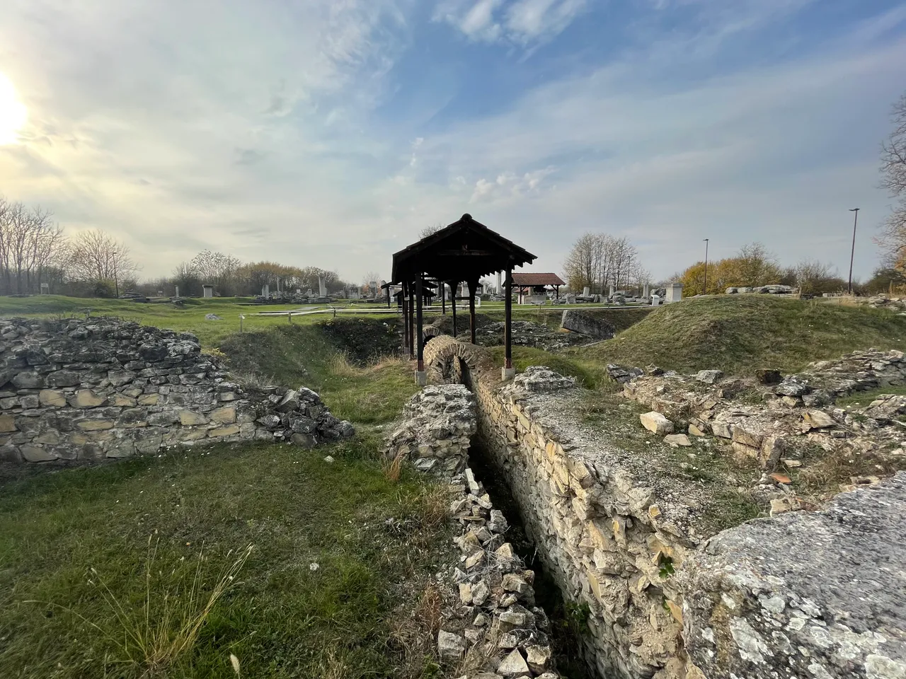
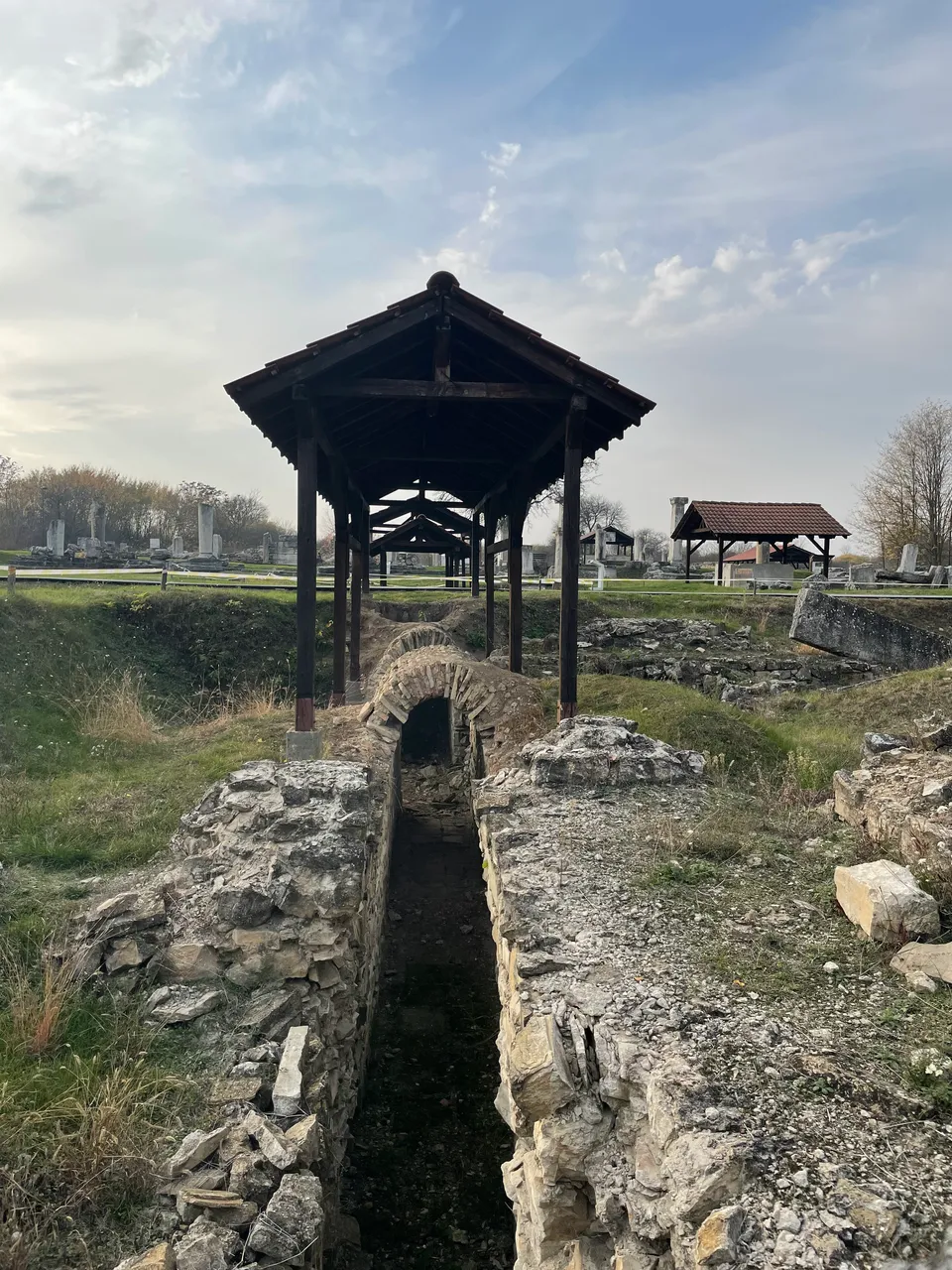
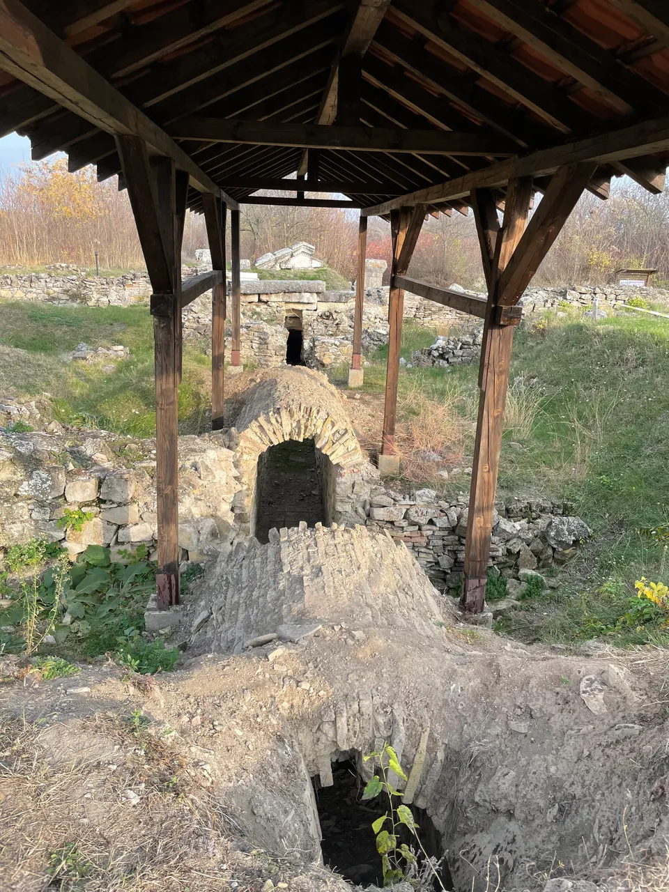
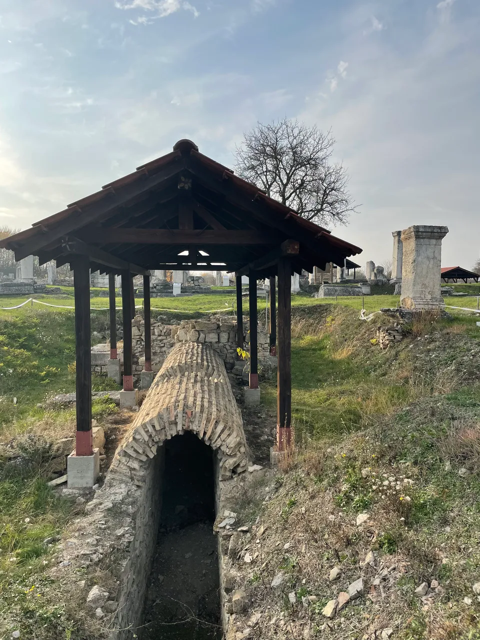
For the outflow of large quantities of atmospheric and waste water a drainage network was constructed, to which the buildings were connected. It was designed according to the natural gradient of the terrain.
BG
За оттичането на голямото количество атмосферна и нечиста вода е изградена канализационна мрежа, с която са свързани сградите. Използван е естествения наклон на терена.
Farewell!
BG
На добър час!
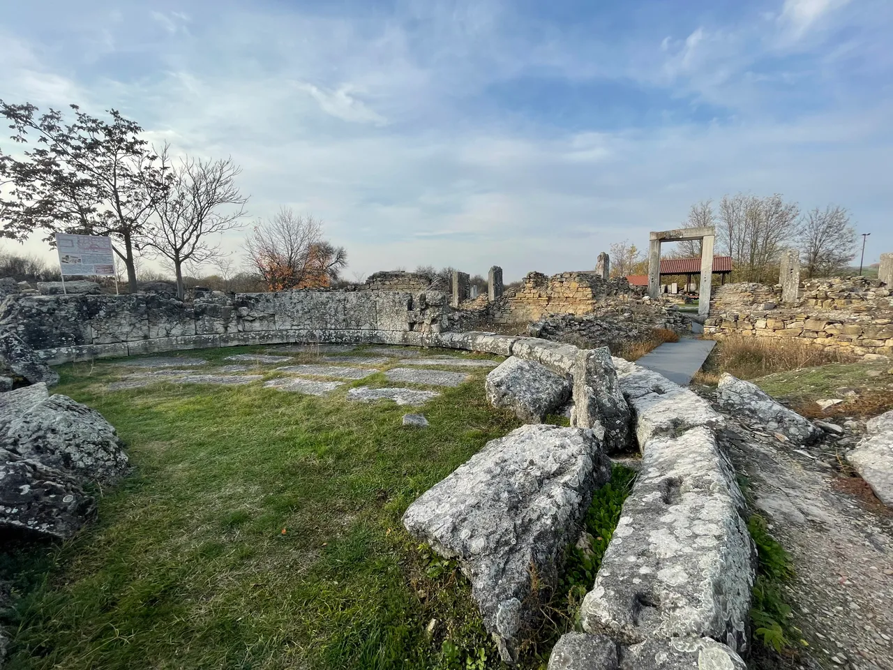
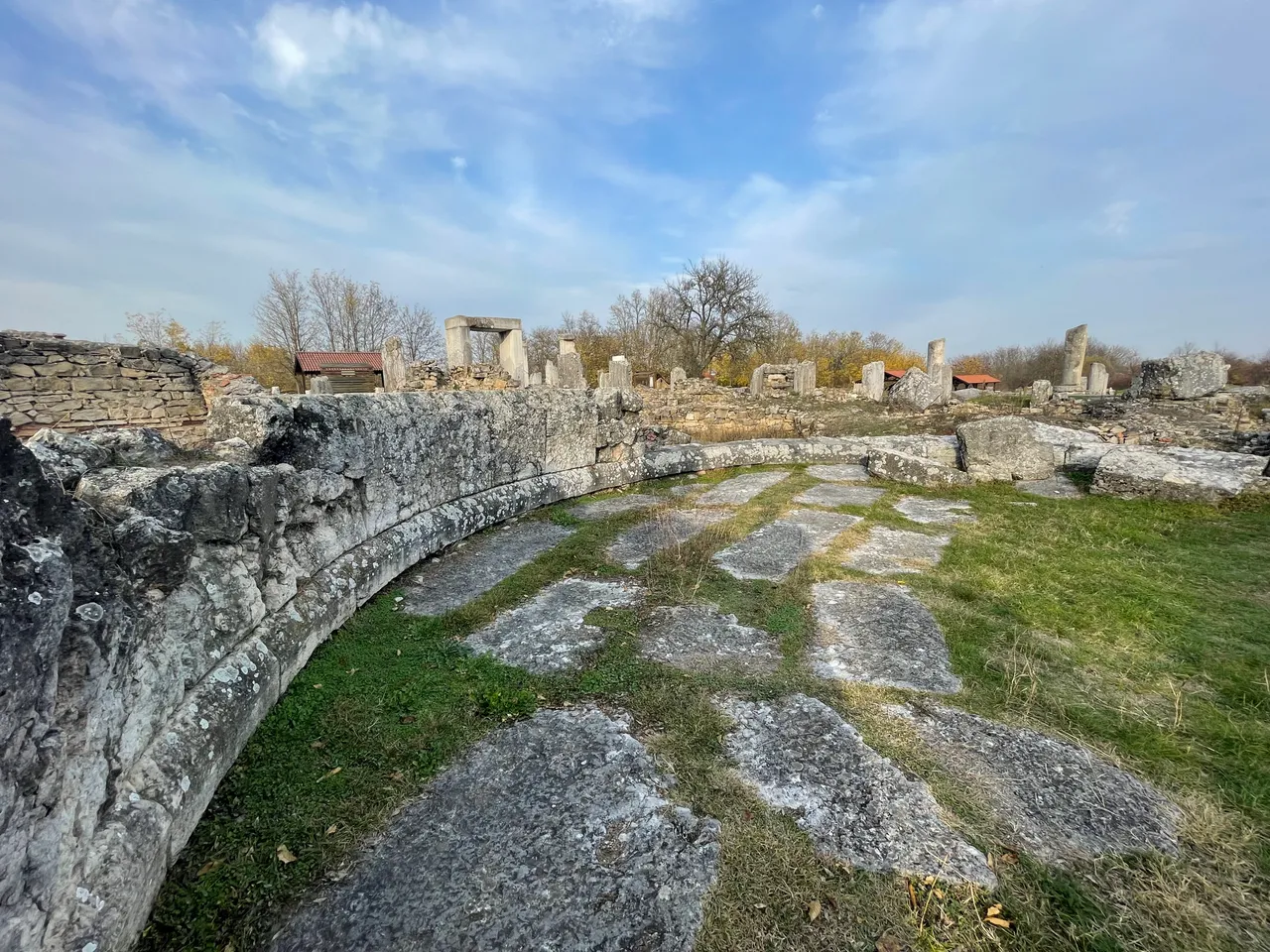
The Odeon
The small theater (odeon) is rectangular in form and has the following dimensions 36,20 m x 28,10 m. The Odeon could accommodate about 350 people.
BG
Одеон
Малкият театър е с правоъгълен план и размер 36,20 m x 28,10 m. Одеонът е събирал около 350 души.
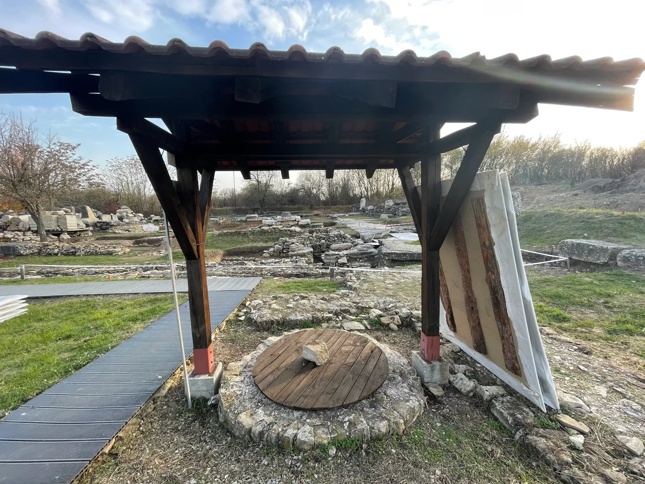
50m away there is a well./ на 50 метра има кладенец
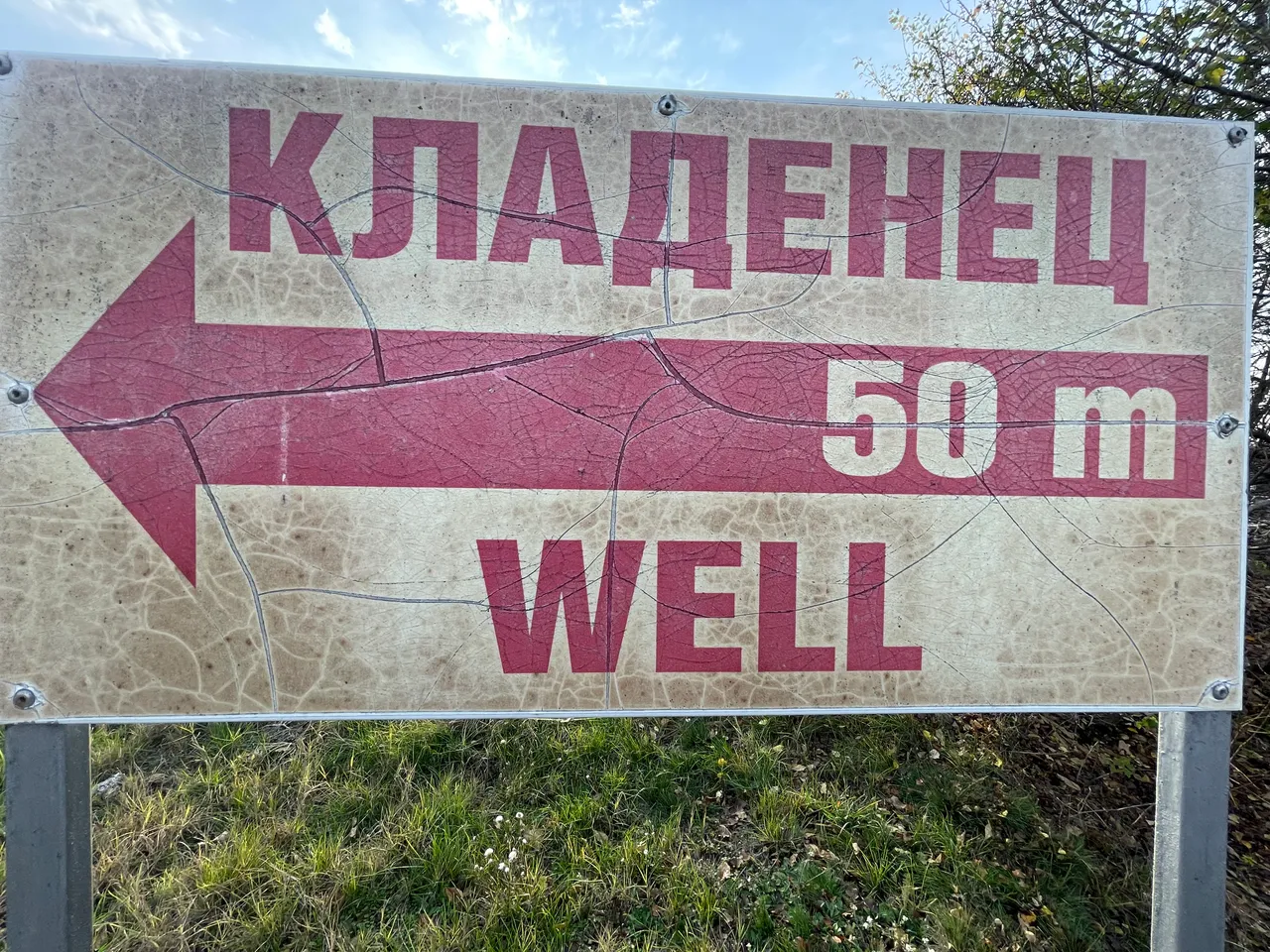
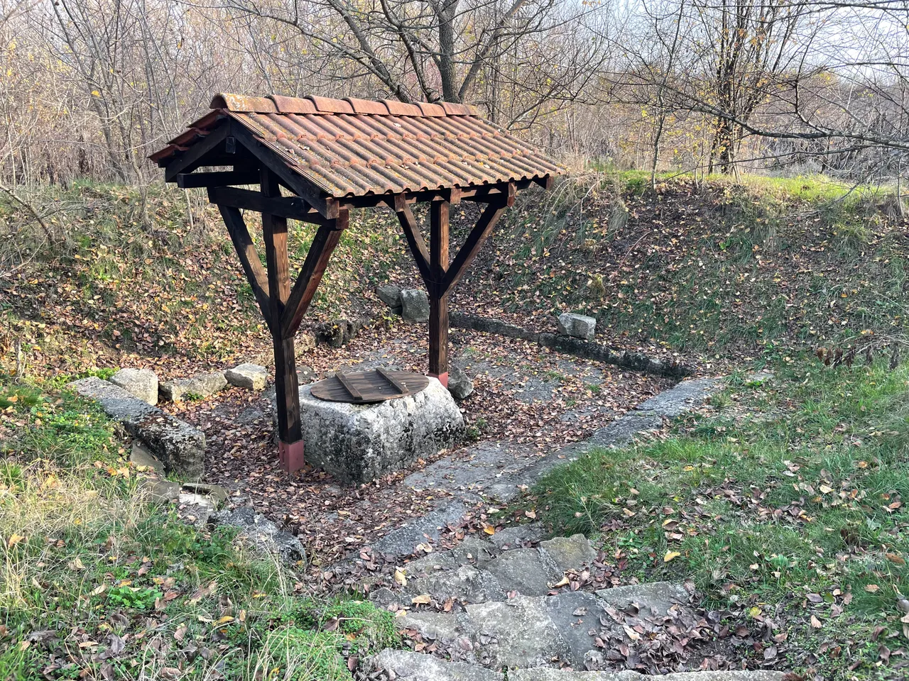
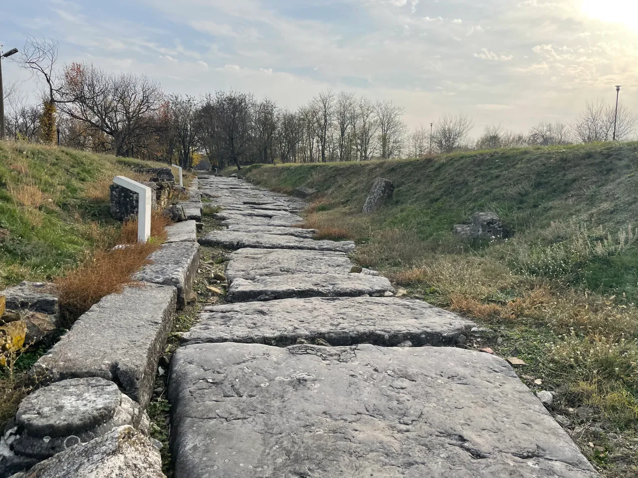
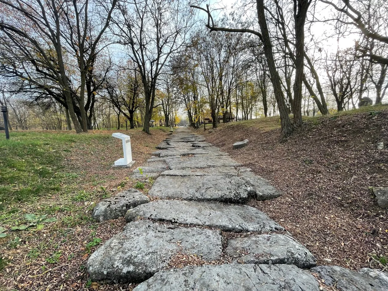
The view from the trail leading to the well is amazing.
BG
Гледката от пътеката водеща до кладенеца е невероятна.
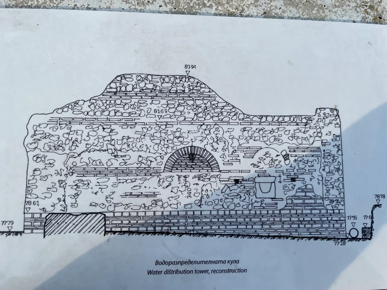
Nicopolis had several sources supplying potable water. The main water supplying source was the western conduit - an aqueduct made of stones, which started from cave near the village of Moussina and was about 25km long.
BG
В Никополис са използвани няколко източника за снабдяване с питейна вода. Главният водопровод е западният - зидан акведукт, който води началото си от пещера при село Мусина и има дължина на трасето около 25км.
The Bouleuterion
The City Council (Boule) had its sessions in the building. It was small in size and its design was almost square in form.
BG
Булевтерион
В сградата заседава Градския съвет (булето). Тя е малка по размери и има почти квадратен план. Главният троен вход е разположен от изток.